Partnair Flight 394

LN-PAA · September 8, 1989

The Accident Investigation Board cleared the F-16 – and the Armed Forces were acquitted in court – based on radar data meant to prove that the distance was too great and that the F-16 flew below the speed of sound. The Flight Data Recorder was supposed to show that everything was normal aboard the Partnair aircraft, until it crashed suddenly and without warning, completely unexpectedly for the pilots.

All of these premises are false. Here is the evidence.

Supersonic speed

620 knots Mågerø
vs
540 knots Skagen

620 knots = supersonic

The Mågerø printout shows an average of 620 knots – supersonic – versus the Skagen printout's 540 knots, over the same 100 seconds at the passage. Recalculating from distance and time gives over 600 knots, confirming that the Skagen values are not real.
Impossible radar positions

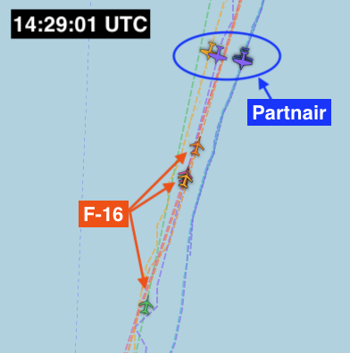
Radar image taken at 14:29:01 UTC where the Skagen, Mågerø and AWACS radars place the same F-16 in three completely different locations along the track, about 15 kilometres between Mågerø and AWACS

Three independent radars – Skagen, Mågerø and AWACS – place the same F-16 in completely different locations at the same instant. Between Mågerø and AWACS they diverge by about 15 km, between Skagen and Mågerø by over 3 km. One aircraft cannot be in three places at once – the radar data cannot be real.

▶ Start radar animation

Anomalies right after the passage

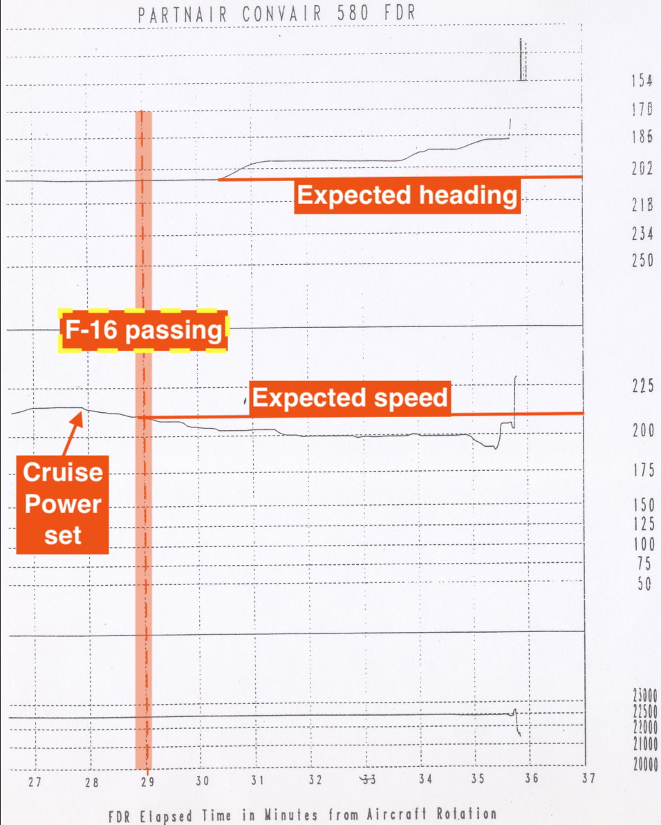
Printout from the Partnair aircraft's Flight Data Recorder where the speed drops in distinct steps right after the F-16 passage, with heading and altitude marked

Everything was normal until the aircraft reached its cruising altitude and cruising speed, but immediately after the F-16 passage the Flight Data Recorder shows anomalies in both speed and heading. The pilots must therefore have known something was wrong.

These are only some of the main points

The full document goes thoroughly through all findings, sources, and analyses in the case.

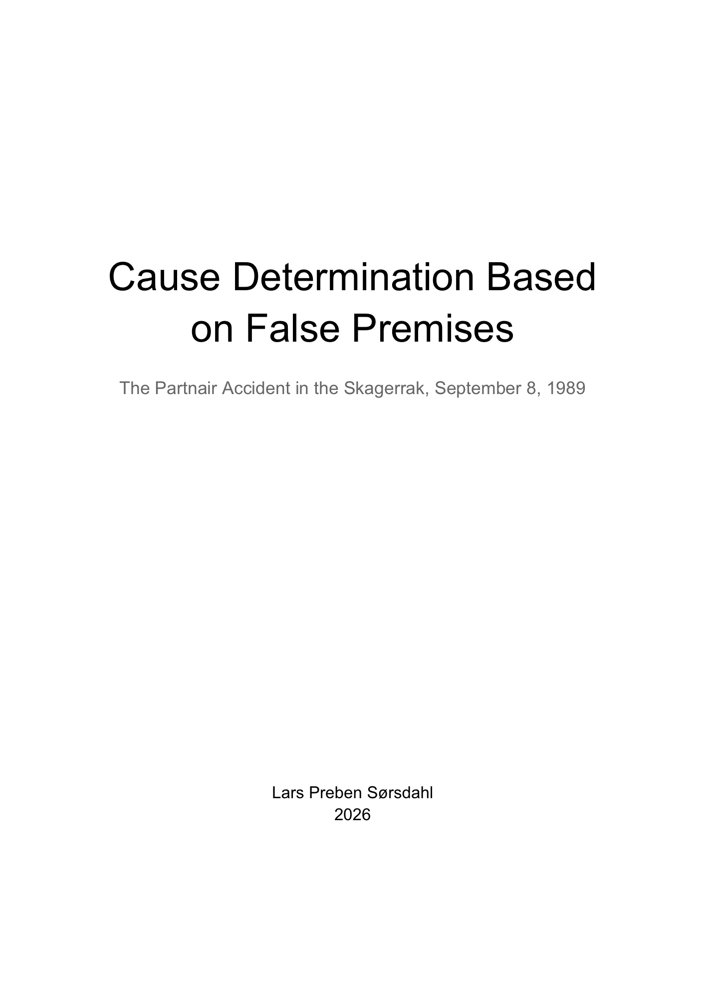
The first page of the document “Cause Determination Based on False Premises”

The full document

False Premises

A thorough review of the accident investigation board's work, written for those who want to understand the case better – with all findings, sources, and analyses gathered in one place.

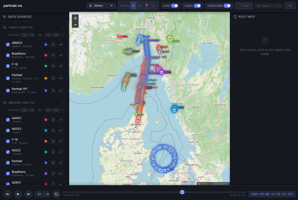
Screenshot of the interactive radar map with tracks from AWACS, Mågerø and Skagen over the Skagerrak

Interactive map

Explore the radar data

Want to take a closer look at the radar data yourself? Open the map with all the tracks from AWACS, Mågerø and Skagen – scrub through time and compare the aircraft.